Written by Rodger Duffett
The Water Harvesting Toolkit is an extension to the Climate Information Platform (CIP) that was funded by the South African Water Research Commission (WRC) under the SmartWater Fund initiative. It provides a link between climate data stored in the CIP and a practical application of the data.
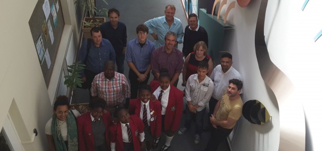
The toolkit was launched last week Thursday at an event attended by representatives from the water harvesting industry, agriculture, city management and researchers in the water arena. Two tools are available in the toolkit.
The first allows a user to step through designing a roof based water harvesting system. After selecting a location on a map the tool prompts for roof size, tank size and consumption patterns for the year. It then provides an analysis of available water for an average year and for the dry-wet range that may be expected for that location.
Learners from the Silikamva High School in Hout Bay demonstrated use of the roof top tool by analysing water harvesting possibilities for their school. Using the tool provoked a more careful look at where water was being used in the school and highlighted the very large usage on toilet flushing! The tool showed that roof harvesting was not a good match for meeting this need at this stage. But ideas for conserving water by improving the toilet system were discussed as were possible other uses for the rain water.
The second tool in the toolkit examines rain water harvesting from the landscape for small dam catchments. This tool uses a clever algorithm to estimate the runoff area from a point selected on the map. The user is then prompted to enter parameters such as land usage to try and refine the runoff. Once again, climate data curated in the CIP provides the engine that drives the analysis. The users can select from various available graphs showing the water availability for average, dry and wet years.
Most of the hard work in developing the tool has been done by Piotr Wolski and has led to some innovative and potentially very useful work in bias correcting CHIRPS satellite rainfall data for the Southern African region. The interactive runoff area calculator is also a unique opportunity for further innovation.
Work on refining the toolkit will continue. This will include refinements to the user interface, extending the help documentation and ongoing improvements to the data sources. Future climate scenarios may also be added in as an option. A valuable addition will be the addition of alternative methods for assessing tank size in collaboration with Jacqui Scheepers from University of Johannesburg.
The support of the WRC in enabling this work is gratefully acknowledged. The toolkit will be integrated into their reports and will be available via various WRC portals.