How vulnerable is UCT to wildfire?
The April 2021 fire will be difficult to forget any time soon. However, two other relatively recent, severe fires threatened Upper Campus. Presumably largely through better luck, meaningful damage was avoided. One spread over from the Vredehoek side in March 2001. During my break times at primary school I watched in horror as it flared up above the campus. The other, starting on the evening of 17 March 2009, was a much closer call, having burnt the edges of the alien forests on Upper Campus’s northern and western perimeter.
Before last year’s devastating fire, concern about the wildfire threat to campus appears to have waned substantially. Hence, one year on, it may be worthwhile to ask: how likely is a repeat of a similar fire? This question is difficult to answer, but we should look at a number of factors, including:
- UCT’s ignition catchment
- Fire weather conditions and climate change
- The fuel load around campus
- Fire suppression
I should make it clear that while I refer extensively to a variety of relevant sources, what follows is built primarily on my own perspectives. In particular, there may be central considerations I am simply unaware of. Getting a more complete perspective on the event and its implications would probably require collaboration among a team with multi-disciplinary expertise, something the UCT community could certainly assemble.
Ignition catchment
UCT’s present ignition catchment is comparatively small. During the fire season, winds mostly come from the south-east. The area to the south-east of UCT is densely built-up and hence unlikely to sustain large fires. To the south, the indigenous Afrotemperate Forest of Newlands would tend to act as a natural fire break: they do not burn easily, as illustrated in the Knysna fires. Between these forests and Upper Campus, however, both in the Old Zoo area and around the Newlands Forest Picnic Site, there are some dense pine and eucalypt stands (including some young ones which appear to have spread from the western forest on Upper Campus), surrounded by grass and dense scrub. A small parcel of this area burnt in the April 2021 fire and fires starting in this area could represent an immediate threat to UCT.
Fires coming from the west or north-west probably pose the greatest risk. However, from the west, fires need to move downslope, decreasing their conventional spreading speed (update 20 April 2022: as Natalia Flores Quiroz points out, embers can be transported over a greater distance in a down-slope wind). UCT’s proximity to the cool Benguela Current means that north-westerly winds tend to bring cool, moist and cloudy conditions to the area, unlike along the south-coast, where pre-frontal air masses can sometimes drive shallow dry off-shore north-westerly flow (as was responsible for the uncontrollable nature of the Knysna fires of 2017 and the Betty’s Bay fire of 2019). This limits the conditions under which fires could seriously threaten campus. However, on occasion, dry off-shore northerly or north-westerly winds do blow, especially in autumn (as in the case of the three relatively recent fires to threaten campus). Such winds tend not to be very strong, but locally wind speeds around Hospital Bend, just 1km north of the campus edge, can gust intensely.
Weather and Climate
The morning of Sunday 18 April 2021 was hot—particularly for mid-April–and the predicted fire danger index very high. The maximum temperatures in °C recorded by the SA Weather Service (SAWS) on the day in the City of Cape Town were: 34.5 at Kirstenbosch, 33.6 at Cape Point, 35.3 at Molteno Reservoir, 36.9 at the airport, 35.8 at the observatory (probably the closest station to UCT and the Game Camp), 37.3 at Atlantis and 38.8 at the harbour. This last reading is suspiciously high and it should be noted that when this station reported 45°C as a maximum temperature in January 2022 the value was disqualified by SAWS quality control, citing problems with the station site. Notwithstanding, this was a notably hot day; a number of other stations in the Western Cape recorded their highest ever April temperatures. Humidity levels–together with wind speeds, the crucial meteorological determinant for fire behaviour–were very low. At 11am, when the fire was at peak intensity, relative humidity was just 10% at Molteno Reservoir (the nearest station reporting humidity values publicly), while 0°C dew points were also reported at the airport at 11am and 2pm.
Understanding the wind behaviour on the day is more tricky. Early in the morning, the air was calm across Cape Town; thereafter, a small-scale trough line moved across the peninsula, driving dry local north-westerly gusts. Relative to the incredible complexity of wind behaviour on Devil’s Peak (to which any cyclist who has tackled the winding tracks on its slopes could no doubt attest), there is very little publicly available wind data for the region. Probably the most relevant readings are from the harbour and airport at 2pm, as 3-hourly wind speeds peaked then. North-westerly winds were recorded in both cases. The wind speed at the airport was 48km/h, gusting to 54km/h; at the harbour it was 24km/h, gusting to 45km/h. Elsewhere in Cape Town wind speeds were much lower and the greatest damage was done by the fire before noon when videos posted from campus do not appear to show particularly high wind speeds. However, local wind speeds on pockets of the mountain could have been even stronger than those recorded, which already suggest very difficult fire fighting conditions. The fire may also have driven its own enhanced wind patterns.
The first three weeks of April 2021, leading up to and during the fire, were unusually warm and dry. Coming at the end of the dry season, this presumably helped prime the vegetation to burn. These conditions persisted throughout South Africa and Namibia’s west coast and the South-Western Cape, indicating that it was part of a robust, regional-scale climate pattern that may recur in future. They were associated with an intense, very slow-moving dome of heat centred over the South African border with Namibia. Despite some rainfall in the last 10 days of the month, for April 2021 as a whole, almost all of the western quarter of South Africa received less than 25% of normal rainfall. Almost the entire winter rainfall region recorded totals in the bottom tenth of the historical range. This fits in with a longer-term pattern of repeated dry early winters in the South-Western Cape, as investigated by a UCT postgraduate student (Mahlalela et al., 2018). This tendency is predicted to get worse with climate change. Both the Southern Hemisphere temperature and pressure anomalies (deviations from normal) for April 2021 indicate a wave-4 pattern that Mahlalela et al. found to be associated with autumn drought, as well as a positive Southern Annular Mode state, that has also been linked to recent drought. The pattern of dry autumn weather is not necessarily unprecedented, however, as a decade-long drought in the late 1920s and early 1930s saw a similar pattern.
The late season warmth that has characterised recent autumns, however, does seem unprecedented. Gridded temperature data from Berkeley Earth (maximum temperatures: April 2021 was the 3rd warmest April after 2017 and 2014), GISS, GHCN, CRUTEMP and ERA5 (average temperatures) all show the warmest Aprils and Mays on record along the west coast and over the South-Western Cape occurring in the past two decades (try it out on the KNMI climate explorer!). In most datasets, the past eight April-May periods have been persistently much warmer than the long-term average.
Long-term, continuous temperature data for individual stations in South Africa are extremely difficult to get hold of, so analysing how extreme the recent conditions were is tricky. Using the R climate package, which pulls South African weather data reported to the WMO through a NOAA server and interpreted by a Spanish website, I’ve looked at running mean temperature and rainfall data at stations along the West Coast. These data tend to be available since 2000 only. I work with the assumption that the warmest periods in this sequence are necessarily among the warmest on record, because of the long-term trends seen in gridded data. For the 3-4 weeks before the fire, rainfall values were among the lowest seen for April at all stations, while average temperatures were closer to those usually seen in January or February than is normal for April. Only in 2014 and 2017 have warmer 21- and 30-day averages been seen in Cape Town at any time between mid-April and September. Further north, 3-4 week average temperatures were the highest on records, with negligible recorded rainfall. Looking at monthly mean maximum temperature for April over 2000-2021, at a number of stations near the West Coast, April 2021 was by some margin the hottest, despite a period of much cooler weather that set in after the fire until the end of the month. Around Cape Town, 2014 and 2017 were generally warmer, but 2021 was well above average.
Performing a full attribution study [UPDATE February 2023: Such an attribution study has now been performed.] of the contribution of climate change to the weather and climate conditions associated with the fire will require a very clear articulation of the precise conditions to be investigated. One could look, for example, at the influence of climate change on seasonal or multi-year heat and drought patterns that are likely to influence fire risk. Alternatively, one could hone in on the specific weather conditions around Table Mountain that placed UCT at risk. Given the findings of recent drought attribution and projection studies for the region, it is highly likely that preceding warmth and dryness during late summer and autumn would be found to have become more common recently due to climate change. However, many other variables that are more difficult to obtain and analyse may also influence plant susceptibility to fire, including wind speeds, atmospheric moisture content and cloud cover.
Fuels
Professor William Bond, a world renowned fire ecologist based at UCT, wrote that we should not jump to conclusions about–or immediately fall back on familiar strategies in response to–this fire. The pattern of burning on campus clearly demonstrates that spot fires were being lit by wind-blown debris, far (as much as 350m) beyond the fire line. This means that fire breaks had little impact on the fire spread. The M3 is about as large and effective a fire break as one could hope for, yet the fire crossed it in multiple different places. Flammable “garden plants”, especially alien palms and cypresses, and creepers on campus were easily set alight by such embers and facilitated rapid fire spread through UCT.
What is less clear, Prof Bond contends, is the ember dispersal properties of the different alien and native plant species around campus and which plants were responsible for the embers that ignited fires on campus. Hence, he suggests urgent research is needed to understand which species pose a serious spotting risk in the South African Wildland Urban Interface (WUI). Furthermore, additional strategies may be required to supplement fuel load management as a fire mitigation strategy—as is being done elsewhere in Mediterranean eco-zones.
Upper Campus was most likely covered primarily by fynbos in pre-colonial times, old stands of which survive on some ridges north and west of campus. The area immediately to the north of campus in the Table Mountain National Park is known as the old Game Camp and is where the fire came from. The area is naturally covered by renosterveld, but it has been badly degraded and heavily invaded by non-native trees, shrubs and grasses. Infamously, the land was previously owned by CJ Rhodes. He demanded that the land be managed as a “European-style parkland” accessible for recreation. The damage done by consequently followed practices is still clearly visible and difficult to correct. Looking at photos from even 20 or 30 years ago shows clearly that SANParks has made significant progress in clearing invasive tree stands. This despite intense opposition, mostly from local recreational users who frequently support “forest” preservation with arguments based on ecological and climatic misconceptions.
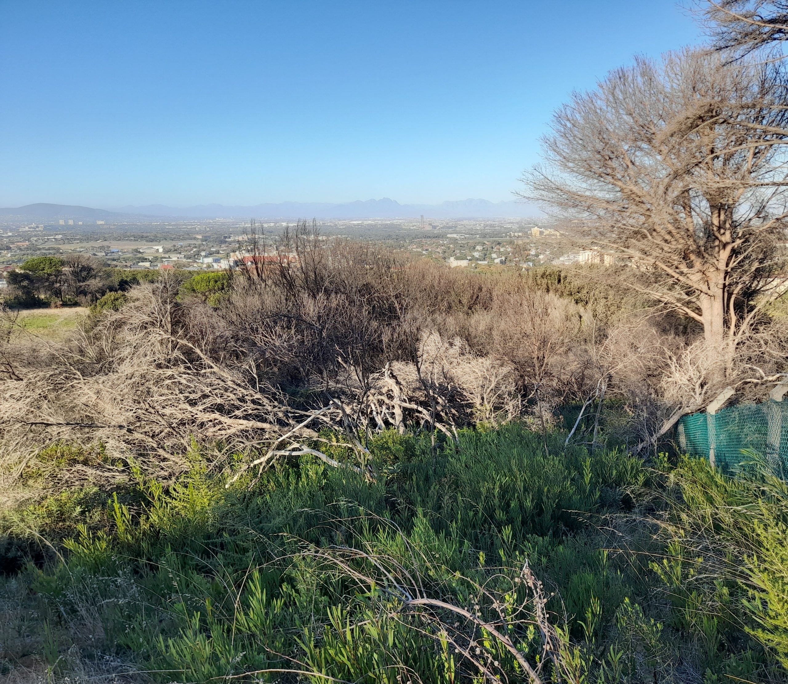
However, dense stands of highly flammable, mostly alien shrubs and low trees dominated the Welgelegen area and southern edge of the Game Camp immediately north of campus (see the figure above). This can be clearly seen in the Google Earth Engine app presented in this article. Completely burnt out tree stumps suggests this area burnt very intensely. It seems as though this may be where the fire rapidly intensified shortly before 11am, from where it went on to destroy the restaurant and enter the UCT property. I went for a run around the Game Camp area a few days before the fire and it was clear that large numbers of young cluster pines were proliferating along the surrounding fence, much more so than even 6 months earlier. Such heavily invaded veld can burn very intensely, and since the trees were not very tall and the surrounding renosterveld was old, not having burnt recently in part due to the small ignition catchment, these pines appear to have burnt out completely. There was also evidence of recent pine felling. Presumably due to the expensive and complex logistics involved in such exercises, wood from trees was visible in piles around some paths before the fire, also helping limit erosion. It is not impossible that these piles of dry, dead wood supplied ready fuel to the fire, but this would also need to be properly assessed. Although SANParks conducted an extensive clearing operation to remove the dead and damaged trees after the fire, a dense thicket of resprouting alien shrubs and trees have already grown to reach shoulder height in the Welgelegen and south-western Game Camp areas. This may need to be monitored as a future fire risk.
In contrast, the large old stone pines that dot the mountain in this area are not invasive. Since they have few low-level branches, fires do not easily ascend to their crowns, unless very intense burning occurs in their immediate surroundings. Prof. Bond notes that the pines on the edge of Madiba Circle were scorched rather than burnt. However, SANParks concluded that large alien trees–particularly pines–were responsible for the intensity of the fire.
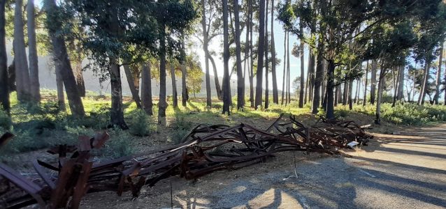
Following the March 2009 fire, a UCT News article suggested that it prompted UCT Properties and Services to look into removing alien trees on the property to reduce fuel load and help mitigate the risks of future fires. The university seemed confident it had the necessary evacuation and emergency plans in place for such events. The removal of a large number of invasive alien trees west of the UCT dam followed. Invasive plant control continues to be practised annually, subject to tight budgetary constraints. Substantial work in this regard was conducted in January 2021.
A 2008 Green Campus Initiative report noted that climate change together with the presence of flammable alien trees would represent a growing threat to campus. A detailed 2012 UCT Heritage Park Management Framework report compiled by consultants hired by UCT suggested numerous initiatives to improve access, pedestrian safety, fire safety, biodiversity management and educational and recreational use of the forested space on campus. However, the 2015 UCT ISCN-GULF Sustainable Campus Charter Report noted that little progress had been made in implementing the 2012 report proposals.
UCT has now removed most of the pine and other alien tree stands along the northern and western perimeter of Upper Campus. Many of these trees were badly damaged by the fire and represented an immediate safety risk. A barren scar has been left behind on the slopes of the mountain, around which an unsightly mess of highly fire-prone invasive thicket is emerging. Planning regarding the future management of these perimeter zones should therefore be urgently conducted. I hope the broad range of expertise and perspectives available on campus will be exploited to this end.
Fire suppression and response
This is another critical but complex determinant of fire outcome. I suspect this is also largely outside the control of the university. Nonetheless, it’s worth reflecting on a few points.
The fire started around 8:40am, apparently deliberately by the occupant(s) of a car travelling on Hospital Bend, according to an Enviro Wildfire investigation commissioned by SANParks. The report notes that the fire appeared manageable when authorities initially responded, burning slowly on a dry grassy slope. When, at around 10am, conditions suddenly deteriorated as the dry gusty north-westerly wind picked up, aerial support was immediately requested (the request to Kishugu for helicopter assistance is currently the subject of a legal battle between UCT’s insurer and SANParks). The Enviro Wildfire report argues that escalation of the fire response occurred as early as possible. It should be noted that the arrival of hot, dry, gusty north-westerly winds during the morning had been forecast in advance for Sunday the 18th. Hence, it may be worth considering whether local weather forecast information could be used more effectively for projecting likely fire behaviour on high fire danger days to allow for proactive planning. I also found it concerning that SANParks only appears to have officially evacuated the surrounding mountain areas after 11:30am, once the fire had already burnt down the restaurant.
There is an emerging consensus that excessive fire suppression (possibly exacerbated by reluctance of WUI inhabitants to allow controlled fires) has set the stage for recent “mega-fires” in Mediterranean-type ecozones. On the other hand, extensive reviews of both the “Great Cape Fires” of January 2000 and the Knysna Fires of June 2017 identified shortcomings in incident command and fire preparedness, the latter possibly linked to fire danger indices used not being sufficiently tailored to local ecological and climatic contexts. However, it is essential to note that both these studies also highlight the extraordinary achievements of firefighters and others involved in these efforts under extremely challenging conditions. This applies again to the Devil’s Peak fire of April 2021, notwithstanding the considerable damage wrought. The fact that no lives were lost in the process (at least five firefighters were injured), despite the proximity to densely populated areas, is testament to exceptional efforts by those involved.
Fires on Devil’s Peak are necessary and inevitable. The native fynbos and renosterveld vegetation are both fire-prone and fire-dependent, whereas introduced tree and shrub species are also adapted to burning and proliferating rapidly thereafter. Hence, as noted by the 2012 Heritage Park report, rapid and explosive spread of fire near UCT is an ever-present risk once fuel loads are restored. If, on a day with severe wildfire danger, a fire starts within UCT’s ignition catchment (for the weather conditions occurring), preparing for evacuations and defending critical buildings would probably be prudent. And all involved should be aware of the risk of spot fires.
Reflections: Where to from here?
What does all of this mean for UCT? While the conditions leading to dangerous fires near campus are relatively rare, they are not without precedent. And their rarity makes the risk of large fuel build up greater. There is also reason to believe the risks will continue to increase due to climate change. As devastating as this fire was, it is far from inconceivable that more dangerous fire conditions may occur in future, that may make avoiding loss of life much more difficult.
We also need to reflect more deeply on UCT’s place in its biophysical surroundings. Does the university have a role to play in shifting perceptions away from colonially-inspired attitudes towards the value of trees in comparison to that of shrubs? Previous reports on land use options for the UCT property and surroundings have consistently referred to the need to protect the “cultural significance” of the “heritage landscape” in line with the vision for the landscape captured in the will of CJ Rhodes, which bequeathed the estate to South Africa. In the light of the RhodesMustFall movement and the 2021 fire, however, we may ask “cultural significance to whom?” and “heritage of what?” UCT may also want to consider the extent to which the pines and eucalypts growing on its property may have contributed to invasion into the surrounding national park, possibly contributing to fuel loads there as well as costs of alien control.
Some have called for replacing exotic trees with indigenous ones. This would provide the advantages of more water-wise vegetation, a reduced risk of soil erosion, and would act as a natural fire break in all but the most ferocious fires. However, these trees grow slowly, may not survive another fire if one occurs soon and were probably not common on these sections of the mountain before, precisely due to frequent fires. Planting them may thus come at the expense of more biodiverse and threatened renosterveld and fynbos vegetation.
Of course, human behaviour and perception also plays a central role in wildfire. As has been pointed out, given the proximity of the flammable vegetation of the Table Mountain range to dense human populations, ignition sources are essentially unavoidable. Whether and how such risks may be mitigated in future is a complex socio-ecological question that I am certainly not qualified to contribute meaningfully to. However, the degree to which many people, including influential local government and powerful lobby group representatives, have focussed on “vagrants” as the primary cause of fire risk is a matter of concern. This despite the fact that the Enviro Wildfire investigation concluded emphatically that the available evidence was inconsistent with a fire started by people living on the mountain. “Vagrants” have been blamed for fires on the mountain since at least 1935. Such finger-pointing is often associated with dehumanising language and further marginalises already vulnerable groups. There seems to be a real risk that homeless and other marginalised people living on or using the mountain may face further hostility in response to wildfires.
There have been suggestions that the focus on the Devil’s Peak fire and wildfire in Cape Town generally is unwarranted. Given the generally limited direct human impact compared to wildfires in other Mediterranean ecozones, the fact that those living in the WUI are often very affluent (though certainly not always; e.g. around Hout Bay or Ocean View) and the frequent devastation caused by large fires in informal settlements that gain considerably less media attention, this is a perspective that is essential to bear in mind when discussing fynbos fires. However, an underappreciated human impact of such fires is from the air pollution associated with smoke. Globally, interest in the substantial associated mortality from wildfire smoke is growing slowly, but local investigations appear absent. Elsewhere, it has been found that the health burden of fire smoke is disproportionately carried by marginalised groups, at least partially due to existing healthcare disparities. The very high concentrations of dangerous fine particulate matter observed near Hospital Bend during the fire is, therefore, cause for concern in our context, too.
Finally, what I will personally miss most after the fire and the consequent removal of the western campus forest, are the magical firefly displays previously visible on warm spring evenings there…